Field Mapping for Paperless Farms
Farms across the U.S. are ditching paper for digital tools, transforming how they manage fields, track tasks, and plan operations. GPS-powered field mapping simplifies recordkeeping, improves accuracy, and reduces errors. These tools integrate with sensors, drones, and satellite imagery to optimize inputs like water, fertilizer, and pesticides - cutting costs and improving yields.
Key takeaways:
- What it is: GPS mapping creates detailed, shareable maps with field data (boundaries, crops, irrigation, etc.).
- How it works: Farmers use smartphones, tablets, or in-cab displays to map fields and add notes.
- Why it matters: Saves time, ensures compliance, improves sustainability, and increases efficiency.
- Tools needed: GPS receivers, rugged devices, mapping software, and optional equipment like drones.
Switching to digital mapping isn't just about convenience - it's about running smarter, more efficient farms.
Tools and Tips for Creating Maps of Farm Fields
Core Tools and Techniques for Digital Field Mapping
To dive into digital field mapping, you need to understand the essential technologies and pick the right equipment for your farm. Many U.S. farms can start with tools they already have and expand as their requirements grow.
GPS and GIS: The Basics
GPS and GIS are the backbone of digital mapping. GPS provides location data, while GIS organizes and analyzes that data into layers, helping farmers make informed decisions. Think of GPS as the tool that collects the "where", and GIS as the system that turns that data into actionable insights.
There are three levels of GPS accuracy to consider:
- Consumer-grade GPS: Found in smartphones and basic handheld devices, this provides 10–16 ft accuracy under open skies. It's fine for rough scouting or simple estimates but may not cut it for precise mapping.
- Sub-meter GPS: With accuracy between 1–3 ft, this is ideal for field boundary mapping, basic guidance, and logging job locations. It includes receivers with SBAS/WAAS capabilities and some agricultural displays.
- RTK (Real-Time Kinematic) GPS: Offering 0.4–1.2 in accuracy, RTK is perfect for tasks like setting permanent field boundaries, drainage mapping, controlled-traffic farming, and creating repeatable guidance lines.
GIS complements GPS by storing and managing data layers. Key GIS layers for paperless farming include field boundaries with acreage and ownership details, soil maps showing texture and drainage, topography for drainage and irrigation planning, crop history, and infrastructure details like lanes, tile lines, and wells. Modern farm mapping platforms make it easy to store and analyze GPS-collected data, like new boundaries or scouting points, directly within the GIS. This integration ensures accurate digital records that can seamlessly feed into farm management systems.
With these basics in place, choosing the right hardware becomes much simpler.
Hardware and Software Requirements
A typical setup for digital field mapping includes a GPS receiver tailored to your accuracy needs, a rugged mobile device for editing maps, and, optionally, in-cab displays for automatic data recording.
- GPS Receivers: These range from handheld units for walking field boundaries to roof-mounted receivers on tractors that integrate with guidance systems. Many modern farm machines, like sprayers and combines, come equipped with built-in GPS units to automatically create coverage maps. The key is matching the receiver's accuracy to your mapping tasks.
- Rugged Tablets or Smartphones: These serve as your main interface for mapping. Look for weather-resistant devices with long battery life and sunlight-readable screens to handle farm conditions. Accessories like mounting brackets, external power cables, and protective cases can help extend their lifespan.
- In-cab Displays: These provide a hands-free option by combining guidance, section control, and mapping. They automatically record field boundaries and coverage maps during operations. While tied to specific machines, tablets and smartphones offer the flexibility to switch between field and office tasks.
Additional tools like drones, soil sensors, and weather stations can add valuable data layers but aren’t essential for basic field mapping.
On the software side, focus on features like easy field boundary creation and editing (whether by walking with GPS or tracing on aerial photos), automatic acreage calculations, and compatibility with common GIS formats (e.g., shapefiles, GeoJSON, KML, ISO-XML). Layer management is crucial, enabling users to toggle between base maps, soil data, yield layers, and other details. Offline functionality is a must for rural areas with limited connectivity, allowing you to view maps and record GPS tracks in the field, then sync data when back online. Integration with job data - like planting, spraying, or harvesting - ties these activities directly to mapped fields, eliminating the need for paper job sheets.
For example, HarvestYield offers tools for mapping fields by driving boundaries or dropping pins. It calculates acreage automatically and integrates maps with job scheduling, GPS-based tracking, weather data, and machine cost tracking. This streamlines operations and supports a fully paperless workflow.
Accurate mapping also relies on high-quality base data.
Sources for U.S. Farm Mapping Data
Reliable base maps are critical for precise digital mapping, and several U.S. government resources provide excellent data for building these maps.
- USDA National Agricultural Imagery Program (NAIP): Offers aerial imagery with a resolution of about 3.3 ft (1 meter), updated every 2–3 years. Many mapping tools include NAIP imagery as a background layer, making it easy to align and digitize field boundaries before refining them in the field.
- USGS and State GIS Portals: Provide topographic maps, digital elevation models (DEMs), and sometimes higher-resolution imagery. These resources are helpful for planning drainage systems, terraces, and access roads by highlighting elevation changes and water flow patterns. State portals may also include layers like county boundaries, roads, and parcel data, which can assist with lease documentation and compliance.
- NRCS Web Soil Survey (WSS): Offers official soil survey data, including soil types, texture, drainage class, and water capacity. Farmers can download GIS-ready data from the WSS to overlay on their field maps, creating management zones for tailored applications of fertilizer, lime, or irrigation. Advanced products like gSSURGO (a gridded Soil Survey Geographic Database) are also available for more detailed analysis.
Commercial satellite providers can complement these free resources by offering higher-resolution and more frequent imagery, often integrated into precision agriculture platforms for crop monitoring and zone creation. These services are typically subscription-based and provide up-to-date imagery during the growing season.
A practical approach for many farmers is to start by downloading NAIP imagery and NRCS soil data for their area. These can serve as base layers in mapping software. From there, approximate field boundaries can be traced in the office, with GPS refining them to the desired accuracy level in the field. This blend of free government data and GPS ground-truthing allows for efficient and accurate paperless field mapping.
Step-by-Step Guide to Mapping Fields Digitally
Creating digital field maps starts with gathering the right tools and data, but the real work lies in following a clear, organized process. A systematic approach ensures accuracy and consistency across all your operations.
Preparing to Map Fields
Before you start capturing GPS coordinates or marking boundaries, take time to organize your system for a paperless workflow. Start by deciding on a field naming convention that everyone on your team can easily understand. Some farms prefer simple names like "Field 1" or "Field 2", while others use more descriptive labels like "North Corn Field" or "River Bottom 40." If you manage multiple properties or collaborate with contractors, consider including identifiers like the farm name or client name (e.g., "Johnson Farm - Field 3A") for added clarity. Whatever system you choose, stick to it - consistency is key.
Standardizing measurement units is another important step. Use acres for field size and feet for smaller features to avoid confusion. Document these choices in your farm operations manual so everyone, from equipment operators to agronomists, is on the same page when recording data.
When it comes to mapping, using the right coordinate system is crucial. The UTM system (Universal Transverse Mercator) with the NAD83 datum works well for most U.S. farms, as it offers local precision and simplifies distance calculations. Since most farms fall within a single UTM zone, this system helps maintain accuracy.
Before you begin mapping, set up client records in tools like HarvestYield. Linking field data with job schedules and historical records upfront makes it much easier to reference information or generate reports later on.
Once your organizational framework is in place, you're ready to map field boundaries and features.
Mapping Field Boundaries and Features
To capture field boundaries, use a GPS-enabled smartphone or tablet with the HarvestYield app. Simply drive around the field's edge, and the app will record GPS points to create a boundary line that matches your path. This works best when the field is clearly defined by features like roads, tree lines, or fences. Many modern tractors with built-in GPS systems can also map boundaries automatically during routine operations, saving you a separate trip.
For fields that are harder to access - due to wet conditions, dense crops, or obstacles - you can walk the boundary with a handheld GPS device or smartphone. Walk at a steady pace and keep the device's antenna pointed toward the sky for the best signal. The recorded track then becomes your field boundary.
If driving or walking isn't an option, you can drop pins on aerial imagery for an initial estimate. With HarvestYield, you can manually place boundary points on satellite or aerial photos by tapping the screen. While this is useful for planning, it's best to verify and refine these boundaries later with on-site GPS data.
Beyond outlining the perimeter, make sure to map key features that impact farm operations. These might include irrigation lines, drainage systems, tile lines, water sources, utility lines, equipment sheds, grain storage areas, and any permanent obstacles. These details are critical for precision farming, helping to explain patterns like drainage issues in yield maps or preventing accidental damage during fieldwork.
After mapping, overlay the boundaries on aerial imagery to identify and fix any discrepancies. For example, GPS drift near tree lines or buildings might cause errors, or you might miss features like drainage ditches. Use satellite imagery as a guide, but rely on your GPS data for precision.
Drones equipped with high-resolution cameras can also help verify boundaries, especially in complex fields. In areas with elevation changes, drones with LIDAR technology can map terrain features that affect water flow and drainage, providing valuable insights for irrigation planning and erosion prevention.
Once your boundaries are complete, they can seamlessly integrate into your paperless system, streamlining farm management.
Measuring and Validating Field Sizes
Accurate field measurements are essential for effective decision-making. Once you've mapped the boundaries, modern software like HarvestYield can automatically calculate the field's area by processing the GPS data. Whether your field is a perfect square or an irregular shape, the software incorporates every GPS point to ensure accuracy.
To confirm these measurements, compare them to independent sources. Start with historical records, such as county assessor data or previous farm surveys, which provide baseline figures. If you have yield monitor data from past harvests, you can estimate field size by dividing the total bushels harvested by the average yield per acre. For additional accuracy, re-walk portions of the field with GPS to spot-check your original data.
Fields with steep slopes may require extra attention. Standard area calculations often underestimate the actual surface area of sloped fields. In such cases, drones with LIDAR technology can provide elevation data, allowing you to adjust the calculations for more precise input application rates and yield expectations.
Documentation is the final step in the validation process. Record the mapping date, the GPS accuracy level (e.g., consumer-grade, sub-meter, or RTK), the coordinate system and datum used, and the name of the person who collected the data. In HarvestYield, this metadata is attached to each field record, making it easy to access for compliance, insurance claims, or lease agreements.
To maintain accuracy over time, establish a seasonal validation routine. At the start of each growing season, compare your digital maps to current ground conditions. Update boundaries to reflect changes like erosion, drainage work, or property line adjustments. Re-check 10–15% of boundary points annually to ensure your GPS equipment is still calibrated and accurate. If a field's acreage changes significantly without an obvious reason, investigate immediately to catch potential errors before they affect your operations.
Cross-referencing your measurements with county tax records adds an extra layer of validation. These legal documents often include acreage figures that should align closely with your digital data. If there are major discrepancies, it might indicate that your boundaries include non-farmable areas or that legal and practical boundaries differ.
Accurate maps are the foundation for a fully paperless operation, guiding every decision you make moving forward.
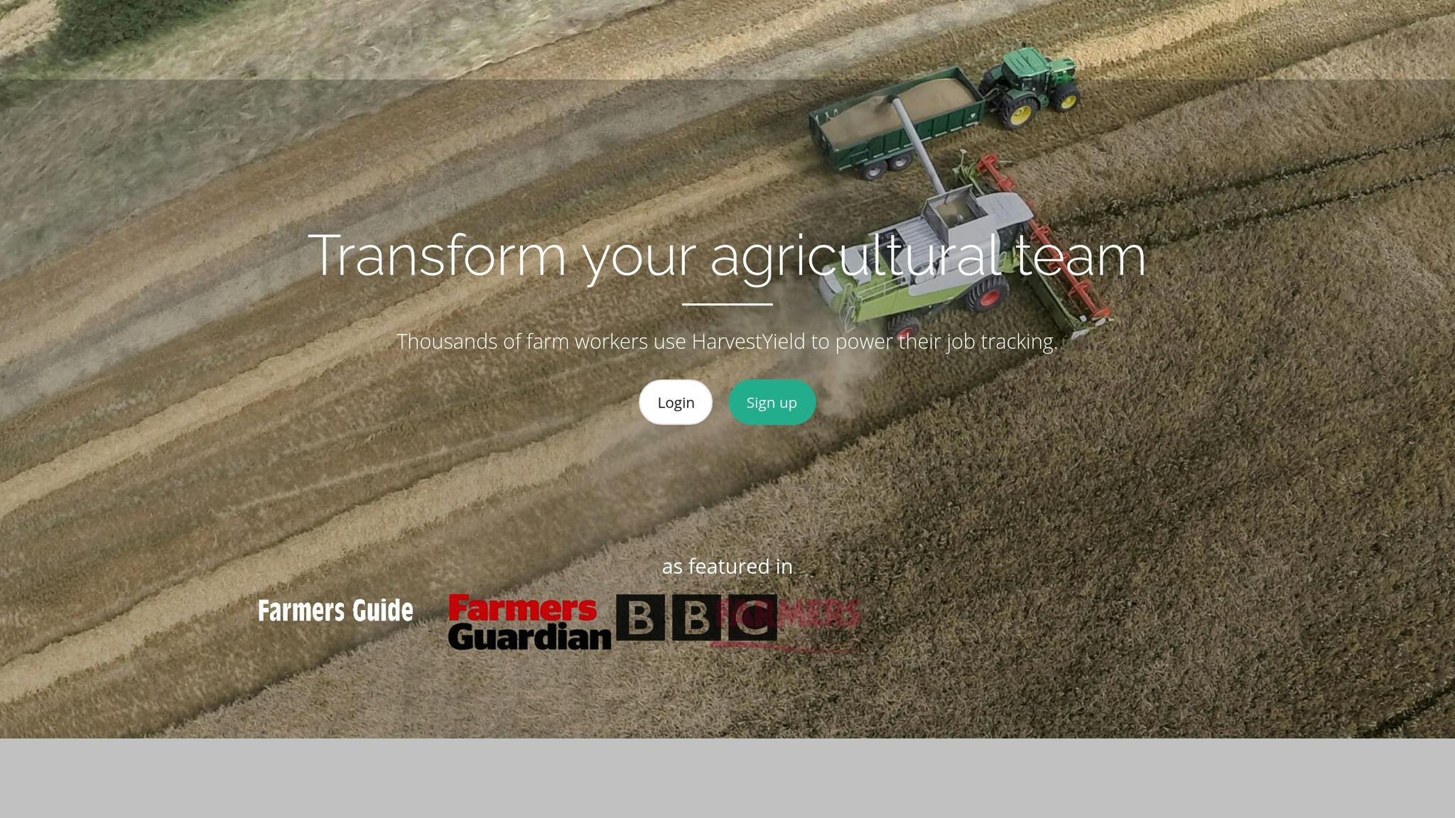
Transform Your Agricultural Team
Streamline job management, field mapping, and machine tracking with HarvestYield. Simplify your operations and eliminate paper job sheets.
ContinueIntegrating Field Maps into Paperless Operations
Digital field maps are more than just visual representations - they become powerful tools when integrated into daily farm operations. By linking these maps to planting records, application logs, harvest data, and job schedules, you create a connected system that transforms raw data into actionable insights. This integration not only enhances traceability but also streamlines compliance and decision-making.
Linking Maps to Farm Records
A paperless system relies on connecting every field activity to its physical location. By tying digital field maps to operational records, you create a traceable system that eliminates confusion, supports compliance, and improves overall management.
Start by assigning each field a consistent identifier in your farm management system, such as "Field 1" or something more descriptive like "North_Corn_2025." This unique ID should be referenced across all records, from planting logs to harvest data. For example:
- Planting records: Log crop variety, seeding rate, and planting date directly to the field's digital map.
- Fertilizer and pesticide applications: Record product type, application rate, method, and timestamp for precise input tracking.
- Harvest data: Automatically sync yield monitor data with the field map to analyze inputs versus outputs over time.
This level of detail strengthens traceability for organic certification and crop insurance claims, providing timestamped, verifiable evidence.
Soil test results can also be tied to specific field locations. Upload lab results to your system and link them to the exact field or zone where samples were taken. Over time, this builds a detailed fertility history, helping you track soil health trends and plan future applications.
Irrigation logs are another critical component. Record dates, durations, and volumes applied to each field or zone. When combined with weather data and soil moisture readings, these logs help optimize water use and document conservation practices for regulatory needs.
Scouting notes further enhance this system. Observations of pest pressure, disease symptoms, or nutrient deficiencies can be logged with GPS coordinates and photos. Over time, these records reveal patterns, such as recurring drainage issues or soil-type performance differences. These insights are only possible when observations are tied to precise locations.
HarvestYield simplifies this entire process by allowing you to attach job logs, photos, and notes directly to mapped fields. With a single click, you can view a field’s complete operational history, supporting both daily management and long-term planning.
Once your records are integrated, GPS tracking takes operational accuracy to the next level.
Using GPS for Job Tracking
GPS technology transforms job tracking into an automated, efficient process that eliminates manual errors and improves accountability. By logging equipment movements in real time, you gain visibility into operations without relying on phone calls or paper reports.
One of the biggest advantages is automated job documentation. GPS records the start time, location, and coverage path as operators begin a task. This eliminates the need for end-of-day paper logs, saving time and reducing errors. For example, sprayers equipped with GPS and section control generate maps showing treated versus untreated areas, ensuring complete coverage and preventing costly overlaps or missed spots.
A Nebraska corn grower reduced seed and fuel costs by $10–15 per acre by using GPS to minimize planter overlaps. Similarly, a Florida vegetable farm cut pesticide use by 12% and labor hours by 20% by ensuring accurate sprayer coverage.
GPS tracking also provides a real-time overview of progress. Managers can instantly see which fields are complete, in progress, or pending, while operators receive turn-by-turn directions to their assigned fields. This shared visibility reduces miscommunication and improves coordination.
Historical GPS data is invaluable for route planning. By reviewing past travel patterns, you can optimize field operation sequences to minimize travel time and fuel consumption. This is particularly useful for farms managing multiple properties or contractors working across client fields.
To measure the impact of GPS tracking, monitor metrics like field coverage percentage, overlap rates, input usage, fuel consumption, labor hours, and machine operating costs.
A Wisconsin dairy farm reduced manure application costs by 18% by using GPS-guided spreaders. This precision allowed them to match application rates to soil test zones and avoid over-application.
HarvestYield automates much of this process, recording job start and finish times, GPS coverage, and weather data. Operators can quickly log material quantities - like seed, fertilizer, or chemicals - directly into the system, ensuring accurate, real-time data flow from the field to the office.
How HarvestYield Supports Paperless Workflows
HarvestYield brings together field mapping, job scheduling, GPS tracking, and record-keeping into a single platform tailored for agricultural operations. Field maps act as the central hub, connecting all activities and eliminating the need for static images stored in separate folders.
When you create a field map using HarvestYield - whether by driving the boundary with the mobile app or marking it on aerial imagery - it’s immediately saved to the client’s record. From there, you can assign jobs to specific fields, complete with turn-by-turn directions for operators. Job sheets are sent directly to operators’ mobile devices, ensuring everyone has the information they need.
As tasks are completed, HarvestYield automatically captures GPS coverage, timestamps, and weather conditions. Operators can input job details - such as application rates or materials used - directly into the app. This real-time data entry ensures accuracy and speeds up administrative tasks like invoicing and compliance reporting.
The platform’s client and field record management system creates a complete operational history. You can track work performed on each field, monitor machine hours and costs, and generate invoices directly from digital records. This seamless data flow reduces delays and minimizes errors.
For contractors, HarvestYield offers team management features that streamline operations. You can assign jobs to multiple team members, with each receiving their tasks and field maps on their mobile devices. The system also tracks employee work history, making it easier to verify completed work and manage payroll.
Additionally, machine cost tracking is built into the workflow. Vehicle repairs, service, and refueling can be logged and linked to specific jobs or fields, giving you a clear picture of operating costs per acre. This helps identify equipment that may be becoming too costly to maintain.
HarvestYield works across iOS, Android, and web platforms with cloud storage, ensuring all data is synced and accessible from anywhere. With everyone - office staff, managers, and field operators - working from the same up-to-date information, coordination improves, and miscommunication is reduced. This unified system simplifies operations, making paperless workflows a practical reality for modern farms.
Best Practices for Maintaining Digital Field Maps
Once you've created your digital field maps, keeping them accurate and secure is essential to ensure smooth, paperless operations. A map from a few years ago might not account for new drainage systems, reconfigured fields, or altered access routes. Regular updates and validation are key to maintaining reliable maps that reflect real-world changes.
Ensuring Data Accuracy and Quality
The foundation of accurate field mapping lies in how GPS data is collected. For most field mapping tasks, GPS accuracy within 1–3 feet is sufficient. While the GPS on consumer-grade smartphones typically offers 10–15 feet of accuracy - adequate for general boundary mapping - it falls short for precision tasks like variable-rate applications or fine boundary adjustments. For higher accuracy, external GPS receivers, such as sub-meter or RTK units, are a worthwhile investment. These devices, which connect via Bluetooth to smartphones or tablets, can achieve accuracy levels of 1–2 inches, making them ideal for defining management zones, marking irrigation lines, or setting legal boundaries.
To optimize GPS performance, map boundaries under clear skies. Dense tree cover, tall structures, or adverse weather can weaken GPS signals. Averaging multiple GPS tracks can also help reduce errors.
Consistency in coordinate systems is another critical factor. Using mismatched coordinate systems can inadvertently shift field boundaries. Ensure all equipment - whether it's tractors, drones, or mobile apps - uses the same coordinate reference system. In the U.S., most agricultural software relies on WGS84 or UTM zones.
Field naming conventions are equally important. Use a unique and consistent naming system, and maintain a written key that links local field names to mapped IDs. This is especially helpful when multiple people are working with the data.
Validation is a must. Compare your digital maps against FSA records, crop insurance documents, and yield maps. For example, if your map indicates 42.5 acres but your FSA record lists 40.8 acres, investigate the discrepancy. A tolerance of ±1–2% is generally acceptable for planning and reporting, but larger differences may point to issues like GPS drift or unmapped features.
When creating management zones, use sufficient sample density and multi-year data. Relying on data from a single season can lead to flawed decisions. Instead, layer yield maps, soil tests, and imagery from multiple years to identify consistent patterns before dividing fields into zones.
Routine Updates and Record Retention
Digital maps should be reviewed and updated at least once a year, ideally before planting season. This ensures that any changes from the previous year are reflected accurately. Recent aerial imagery from sources like Google Earth, USDA's Crop Data Layer, or state GIS portals can help verify boundaries and identify discrepancies.
Immediate updates are necessary for:
- New field boundaries resulting from land acquisitions, leases, or subdivisions
- Major infrastructure changes like irrigation systems, drainage tiles, or fencing
- Significant landform changes, such as erosion or leveling
- Permanent cropping shifts, such as converting row crops to orchards or long-term cover crops
For temporary features like cover crop zones or strip-till lines, seasonal updates can be documented in separate layers or notes without altering the master boundary.
Version control is crucial for long-term data management. Never overwrite your master field boundaries. Instead, create new map layers for each crop year, such as "2023_boundaries" or "2023_yield." This practice not only preserves historical data but also supports trend analysis, audits, and lender or insurer inquiries.
Keep historical maps for 5–7 years to meet USDA, FSA, and crop insurance requirements. This timeframe also provides valuable insights into yield trends, soil health, and management decisions. Organize these maps in a structured folder system by farm, field, and year. For file formats, use industry standards like Shapefile (.shp), GeoJSON, or KML/KMZ for vector data, and GeoTIFF for raster maps.
To safeguard your data, periodically export backups - like shapefiles and CSVs - to local or external storage. This adds an extra layer of protection against cloud platform outages, accidental deletions, or account issues.
When collaborating with contractors or custom applicators, share read-only versions or PDFs of your field maps to prevent accidental edits while ensuring accurate job execution.
Data Security and Access Management
Field maps often contain sensitive operational data, so they should be treated with the same level of care as financial or legal documents.
Store your maps on trusted cloud platforms that offer encryption, audit logs, and role-based access control. Cloud storage provides benefits like automatic backups, multi-device access, and protection against hardware failures. Platforms such as HarvestYield allow you to manage access levels, ensuring only authorized users can view, edit, or export data.
Assign access based on job roles. For example:
- Managers: Full access, including editing and exporting data
- Operators: View-only access to fields, guidance lines, and prescriptions
- Consultants or agronomists: Read-only access to specific fields or farms
This layered approach reduces the risk of accidental changes or unauthorized sharing.
Strengthen account security with strong, unique passwords and enable multi-factor authentication (MFA) whenever possible. MFA adds an additional layer of protection, particularly for accounts containing sensitive data.
Develop a clear offboarding process for seasonal employees and contractors. Revoke access and update shared credentials at the end of each season to prevent unauthorized access.
Avoid sharing raw GIS files via unsecured methods like email or USB drives. Instead, use secure sharing tools or temporary links with expiration dates. If you need to share data with a consultant, export a PDF or read-only image rather than editable files.
Finally, clearly define data ownership in contracts with agronomists, drone service providers, and software vendors. Specify who can access or reuse the data and under what conditions. This ensures you maintain control over your records.
For secure access, avoid using public Wi-Fi. Instead, rely on a VPN or your mobile carrier's secure network when working remotely to protect your data during transfers or updates.
Conclusion: The Future of Paperless Farms
Digital field mapping has evolved from being a helpful tool to becoming the backbone of modern farming operations. By replacing paper-based records with integrated digital systems, farms are transforming how they manage resources, monitor activities, and plan ahead. For instance, a recent initiative in digital field mapping led to a 30% reduction in water usage while boosting organic yields - clear evidence of the power of data-driven decision-making.
Making the switch to paperless operations comes with a host of benefits. Farms can eliminate errors caused by manual data entry and maintain permanent digital records, which are invaluable for meeting regulatory requirements and achieving organic certifications. Digital maps offer a centralized view that combines field boundaries, soil data, irrigation layouts, and crop zones. This level of integration allows every decision - whether it’s planting, applying inputs, or recording harvests - to tie back to a specific location. The result? An auditable trail that simplifies everything from lease agreements to regulatory compliance and even farm valuations.
Technology isn’t slowing down. AI-powered platforms are now turning satellite and drone imagery into actionable alerts, predicting floods, droughts, pest infestations, and disease outbreaks before they happen. Real-time sensor networks, like those monitoring soil moisture, temperature, and nutrients, provide continuous insights that help farmers make informed decisions throughout the growing season. These advancements are bringing precision agriculture within reach for farms of all sizes, streamlining operations and enhancing efficiency.
Practical tools are key to making this transition seamless. HarvestYield is one such platform, designed to replace paper records entirely. It captures GPS and weather data in real time, schedules tasks with turn-by-turn directions to fields, tracks job start and finish times automatically using GPS, and keeps detailed client records of all work performed on each field. This kind of integrated system simplifies workflows and ensures nothing falls through the cracks.
The message is clear: adopting digital field mapping now sets farms up to take advantage of future technologies as they emerge. Incrementally integrating tools like HarvestYield not only avoids the need for a disruptive overhaul later but also builds a scalable foundation for long-term success. The real question is, how quickly can your farm embrace these systems? The answer could shape the future of competitive farming for years to come.
FAQs
What are the key advantages of switching from paper-based to digital field mapping on farms?
Switching to digital field mapping transforms how farmers manage their operations, making processes smoother and more organized. Instead of relying on paper job sheets, digital tools allow you to map and measure fields, maintain detailed client records, and track machine costs - all within a single platform.
By incorporating GPS data, digital mapping ensures precise field boundaries and measurements, significantly improving accuracy and saving time. This method cuts down on paperwork while boosting collaboration among team members and increasing overall efficiency.
How does GPS accuracy impact digital field mapping, and what level of precision is best for different farming tasks?
GPS accuracy is a key factor in ensuring dependable and precise digital field mapping. It becomes especially important for tasks like planting, irrigation planning, and defining field boundaries, where even minor inaccuracies can cause inefficiencies. For general field measurements or tracking work, sub-meter accuracy typically does the job. However, tasks that demand finer precision, such as planting or spraying, often benefit from centimeter-level GPS accuracy.
With tools like the HarvestYield app, you have the option to map fields by either driving along the perimeter or placing pins to outline boundaries. This adaptability lets you choose a mapping method that matches the accuracy requirements of your farming activities.
How can I protect the security and privacy of digital field mapping data on my farm?
To protect your farm's digital field mapping data, start by limiting access to authorized users only. Set up individual accounts for each operator, allowing you to control permissions and monitor activity effectively. Make sure to store your field maps and related measurements on a reliable platform that offers encryption and robust privacy features.
Keep your passwords and software up to date to guard against potential security risks. It's also a good idea to back up your data regularly to avoid losing important information. These practices help ensure your farm's data stays secure while enabling smooth, paperless management.